🏊 LKSC — where are we swimming?
Generated 2026-09-30 13:00 IST.
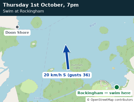
| Location | Wind exposure | Wind you'll feel | |
|---|---|---|---|
| Lough Key Forest Park (Rockingham) | 25% | 6.2 km/h | wind map |
| Doon Shore | 73% | 18.2 km/h | wind map |
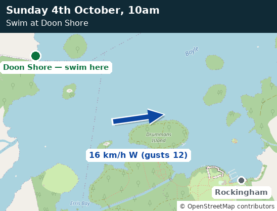
| Location | Wind exposure | Wind you'll feel | |
|---|---|---|---|
| Doon Shore | 25% | 3.6 km/h | wind map |
| Lough Key Forest Park (Rockingham) | 81% | 11.8 km/h | wind map |
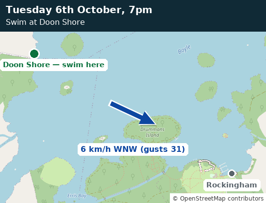
| Location | Wind exposure | Wind you'll feel | |
|---|---|---|---|
| Doon Shore | 25% | 3.3 km/h | wind map |
| Lough Key Forest Park (Rockingham) | 99% | 13.3 km/h | wind map |
Live wind map
Live wind over Lough Key, from Windy.com — the same view we used to check by hand. The moving streaks show which way the wind is blowing. Use the play bar along the bottom of the map to move forward to the session day and time. Doon Shore is at the north-west corner of the lake; the Rockingham entry point is on the south-east shore, near McDermott's Castle.
How we pick the spot
The two swim spots are close together on the same lake, so the wind forecast is the same for both. What matters is the wind's direction. A shore is calm when the wind blows from the land behind it, and choppy when the wind has travelled across the whole lake before it arrives — waves build up over open water.
Doon Shore is on the north-west side of the lake, so south-easterly winds make it rough. The Forest Park beach is on the opposite side, so north-westerly winds make it rough. For each session we estimate how rough each spot will feel by combining the wind speed, the gusts, and how directly the wind blows onto that shore, and we pick the calmer spot. When there is little between them, we say it's a close call — either spot will do.
In the table above, wind exposure is how open a shore is to the forecast wind direction: 100% means the wind blows straight across the lake onto it, 25% means the wind comes off the land behind it. Wind you'll feel is our estimate of the wind at that shore — the forecast wind and gusts, reduced by that shelter. It is what we compare to pick the spot.
Where the numbers come from: wind forecasts are produced by weather models — computer simulations of the atmosphere run several times a day by national weather agencies. Ours comes from the model run by ECMWF, the European weather centre, widely regarded as the most accurate in the world. Websites like Windy don't make their own forecasts — they display the output of models like this one. This page reads the very same model's numbers through a free service called Open-Meteo, so what you see here and what you see on the Windy map above should agree.